What does listing photography & videography cover in Darnestown?
Buyers in Darnestown usually see your home online long before they see it in person, so the photos and video do the first showing for you. This service covers getting the house ready, capturing it in good light, editing the files and delivering them in formats listing sites accept.
- Shoot prep: We walk through the house with you first and suggest what to declutter, move or light so each room photographs well.
- Interior and exterior photos: A professional photographer captures the key rooms and the outside with balanced light and straight lines.
- Video walkthrough: A short guided video shows how the rooms connect, which still photos can't do on their own.
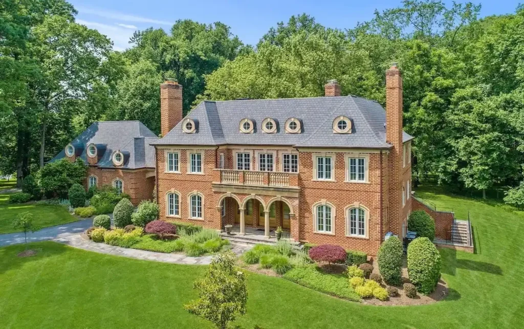
- Drone and aerial shots: Where it's allowed and useful, aerial views show the lot, the roofline and what sits around the property.
- Floor plans: A measured layout helps buyers picture their furniture and compare your home with others they're considering.
- Interactive virtual tour: Buyers can move through the home at their own pace and return to it as often as they like.
- Editing and delivery: Images are color corrected and sized for the MLS, listing sites and social posts.
Can drones fly over Darnestown listings?
Yes, with conditions. Darnestown sits 17.0 to 21.7 nautical miles from Reagan National, beyond the Flight Restricted Zone but within the Special Flight Rules Area. The FAA allows non-recreational flights there when the pilot complies with Part 107, so we book licensed pilots only.
Darnestown at a glance
| Service | Listing photography & videography |
|---|---|
| City | Darnestown |
| County | Montgomery County, MD |
| Median home value | $958,200 (owner-occupied homes, Darnestown CDP, 2020-2024) |
| Agent | Levi Loveless, RE/MAX Realty Group |
| Licensed in | Maryland and Virginia |
| Office | 7373 Wisconsin Ave Suite 1700, Bethesda, MD 20814 |
| Phone | (301) 275-7744 |
Source: U.S. Census Bureau, American Community Survey 2020-2024 5-year estimates, table B25077.
“They were fierce negotiators and worked tirelessly to get me a reduced sales price, which is a testament to their skill and expertise.”
Monica Z., Google review
Realtor with professional photography in Darnestown, MD
Does my listing agent pay for photos in Darnestown, MD?
With us, yes. Professional photography is part of our listing service, and for Darnestown homes on acreage we plan for exterior and grounds coverage too. Other agents handle it differently, so ask before signing any listing agreement. Paying for photos yourself is rarely necessary when your agent includes them.
How do I prepare for listing photos on a Darnestown home?
Clear counters, remove personal items, open blinds, replace burnt bulbs and put cars away from the drive. For Darnestown properties, mow the lawn, trim beds and tidy outbuildings, pastures or pool areas, since exterior shots carry a lot of weight. We send a room-by-room checklist the week before the shoot.
Can my Darnestown listing use virtually staged photos?
Yes, as long as the listing clearly says the photos are virtually staged and shows the empty room too, so buyers are not misled. Virtual staging works well in large, empty Darnestown rooms where buyers struggle to judge scale. It should never hide defects or change permanent features.
Do listing videos help sell homes in Darnestown, MD?
They often do for larger homes and properties with land, because video shows layout, flow and grounds better than still photos. Many Darnestown buyers relocate from elsewhere and tour online first. A short, well-edited video with a walkthrough of the property lines and outbuildings helps those buyers decide to visit.
What photos sell a house in Darnestown, MD?
Clear, bright shots of the main living spaces, kitchen and primary suite, plus wide exteriors that show the lot, setting and privacy. For Darnestown homes, aerial or elevated views of the land and photos of barns, pools or gardens help buyers see value they cannot judge from the street.
Are drone photos worth it for a Darnestown home on acreage in MD?
Usually yes. Aerial views show lot size, tree lines, outbuildings and the approach in a way ground photos cannot. Darnestown sits beyond the Flight Restricted Zone, so a licensed pilot can fly under standard FAA rules. Levi Loveless plans the aerials alongside the ground shots.
Why choose a realtor with professional photography in Darnestown, MD?
Buyers see the photos before they see the house, and large Darnestown properties are hard to capture with a phone. Levi Loveless can arrange a professional photographer, video and aerials for the listing, and plans the shot list around the home's best rooms and land.
Tell us about your move. Levi or Taylor will reply personally, usually the same day.